Guide X-001
Taylor Sanchez, Rossana Sallenave, Amy Ganguli, and Katie Meiklejohn
College of Agricultural, Consumer and Environmental Sciences, New Mexico State University
Authors: Respectively: Natural Resource Director, Sierra Soil and Water Conservation District, NM; Extension Aquatic Ecology Specialist, Department of Extension Animal Sciences and Natural Resources, New Mexico State University (NMSU); former Associate Professor, Department of Animal and Range Sciences, New Mexico State University and currently National Program Leader, National Institute of Food and Agriculture, U.S. Department of Agriculture; Working Landscapes Program Manager, Ranch Advisory Partners, MT (Print Friendly PDF)

Photo 1. Monitoring the weather is a crucial part of ranching and farming life, and new tools can help with a changing climate. Photo courtesy of Chali Simpson.
INTRODUCTION
Throughout the western United States, the most pressing issues affecting agricultural producers are drought, higher temperatures, increasing variability in frequency and intensity of precipitation, and plant species invasion. Ranchers and farmers may wonder how long a drought will last or how their productivity will be influenced by weather in any given year. Landowners are aware of the challenges posed by these issues but may not understand how climate and weather can drive those challenges. This fact sheet aims to define a few weather and climate terms and explain the importance to landowners and producers of monitoring climate patterns to make more informed decisions regarding their land and better anticipate, adapt, and manage for changing climatic conditions. It also outlines resources available to landowners to assist them in their climate monitoring efforts.
CLIMATE VS. WEATHER: WHAT’S THE DIFFERENCE?
The terms weather and climate are sometimes confused because both describe the state of the atmosphere but at different geographic and time scales. Weather describes the atmospheric conditions at a specific place and time, while climate describes the long-term weather patterns across a particular region (typically averaged over 30+ years). For example, you can step outside in a location unfamiliar to you and readily describe the weather, but without some time or historical context, you will not be able to describe the climate. To further illustrate the difference between weather and climate, your area may experience a sudden extreme drop in temperature one day (i.e., weather), but over the past decade, winters may be milder than they used to be (i.e., climate). To better prepare and adapt to weather patterns occurring on your land, it helps to know if these patterns are consistent with climate trends in your area or if they are new and highly unusual and fall outside the normal climate patterns to which vegetation and biota have adapted.
PRECIPITATION TYPE, AMOUNT, DURATION, INTENSITY: WHY DOES THAT MATTER?
Commonly observed types of precipitation include rain, drizzle, hail, sleet, and snow. The amount, duration, and type of precipitation will all affect the infiltration rate, which is the rate at which water will move into the ground from the surface. To further illustrate, imagine the different effects of quick, high-intensity rain on the soil surface compared to a slow, long-lasting drizzle. One can lead to extreme surface runoff and erosion, while the other allows the rainwater time to be absorbed deep into the soil profile and into the rooting zone for maximum plant availability. The most informative weather and climate summaries not only provide the amount of precipitation received but also the type and duration of each precipitation event.
TEMPERATURE: HOW DOES IT AFFECT RANGELAND PLANTS AND CROPS?
Atmospheric air temperature is a critical driver behind the rate and timing of plant growth and development. Commonly recorded temperature observations include the maximum and minimum temperatures reached or the absolute average over a given time. Like precipitation readings, the more frequently the temperature readings are taken, the better. This helps to ensure that extreme temperature values are not missed or overlooked, which can happen when only average temperatures are considered. Intense fluctuations in temperature can disrupt the natural environmental cues that trigger plant growth and development at specific times of the year to coincide with other organisms supported by these plants.
For example, higher-than-expected temperatures earlier in the growing season can cause key species (plant species that are important indicators of rangeland health) to produce reproductive flowers sooner than normal. Once temperatures drop back down to normal values, those plants no longer have the thermal energy required to support that new growth, causing those species to be stunted for the rest of the year. An effective way for producers to monitor and be prepared for such an occurrence is to identify key plant species on their property and note when they are reaching specific growth stages, such as growing a certain number of leaves, reaching a particular height, or flowering stage. This will help producers to optimize the timing of management practices like grazing, herbicide application, and planting and harvesting dates.
HISTORICAL AVERAGE AND DEVIATIONS FROM NORMAL: WHAT DO THOSE TERMS MEAN?
Historical average is a term commonly used to describe weather conditions observed over a long period of time and is often used to characterize “normal” conditions. By identifying historical/normal conditions, scientists and climatologists can develop predictive models to plan better and manage for future climate conditions. Many different predictive models available to landowners aid in adaptive management decisions. Adaptive management refers to the active learning process whereby management plans continually evolve and adapt based on changes in the environment that are identified through monitoring. Examples of adaptive management can be as simple as deciding to keep a herd on a pasture longer based on current vegetative conditions or may involve complex monitoring and evaluation procedures. Historical climate summaries help make predictions and identify and manage for deviations from normal (conditions that differ significantly from what is expected for that type of climate). The climate monitoring methods described in this document, coupled with simple but equally important observations in the field, can assist producers in developing an adequate adaptive management plan to help mitigate the impacts of these deviations from normal.
SPATIAL VARIABILITY AND EXTREME CONDITIONS: HOW ARE THEY DEFINED?
Many landowners are familiar with the expression “rain doesn’t fall the same on all,” which is an example of spatial (geographic) variability. This phenomenon refers not only to differences in intensity and amount of precipitation across a region but also to differences in other weather and climate variables such as temperature, humidity, and wind. Differences in topography, elevation, soil type, and vegetation can all contribute to spatial variability. Extreme weather events are those that differ significantly from the established historical averages. These include unusually high or low temperatures, unusually severe storms or precipitation events, and drought. These conditions can have devastating effects on plants and animals, regardless of their duration. Planning for extreme events is a large component of adaptive management and can save your operation from devastating losses.

Photo 2. Spatial variability in precipitation on rangelands. Photo courtesy of Chali Simpson.
RESOURCES AVAILABLE TO YOU
Climate monitoring systems use information obtained from satellite observations, ground-based data, and predictive models to monitor and forecast changes in weather and climate. Incorporating climate monitoring into producers’ management plans has become increasingly important as weather patterns shift and climate variability increases. In recent years, we have seen weather events and patterns that are unlike what historically constitutes the climate regime. This is commonly referred to as climate change. Agricultural productivity is vulnerable to these changes in climate, which is something that cannot be controlled. Producers can only anticipate those changes and adapt to them by adjusting the type and timing of management practices accordingly. Several resources are available to you as a landowner created by professionals to help aid in these efforts. Here are a few examples:
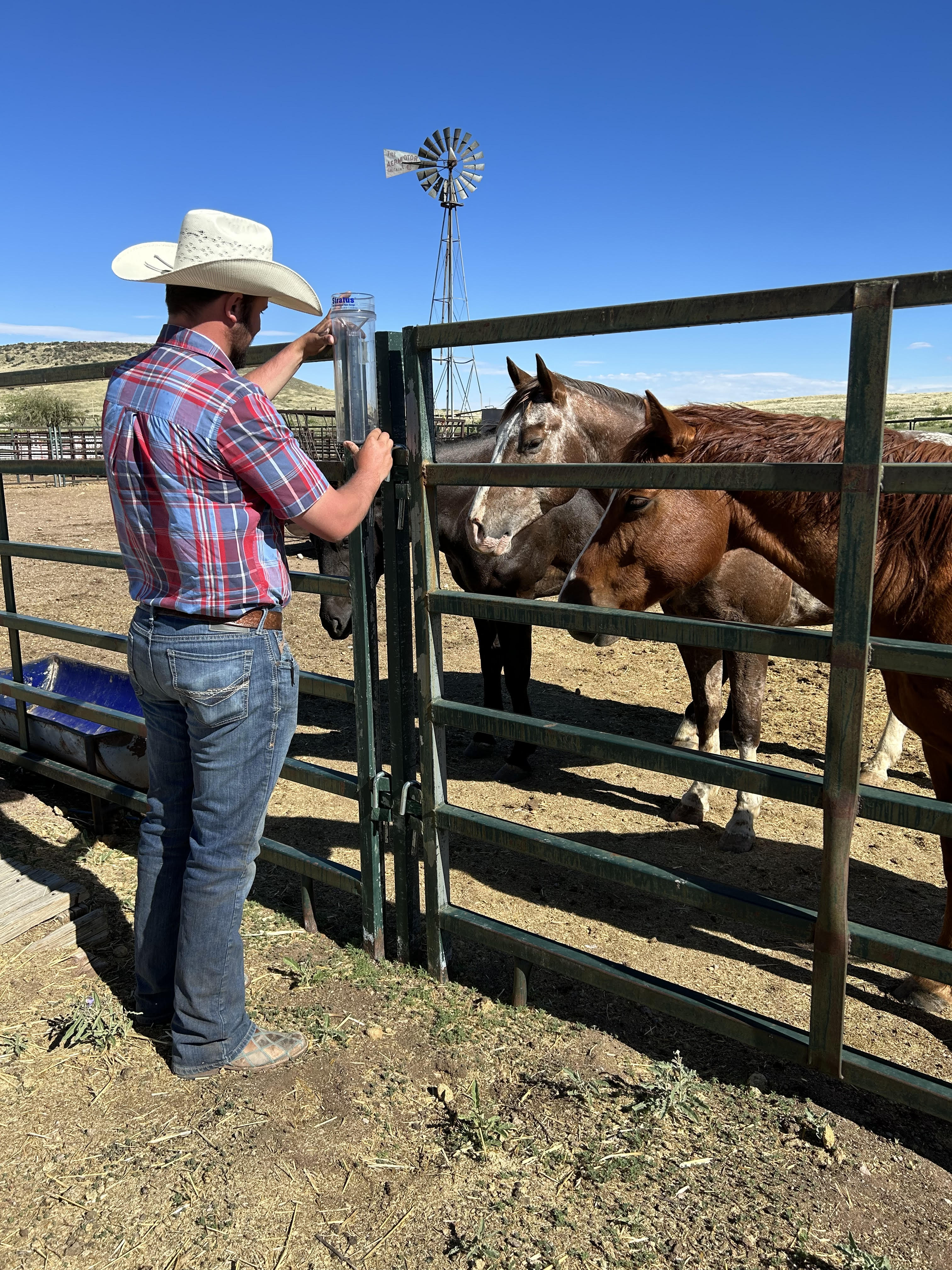
Photo 3. Using a rain gauge provided by CoCoRaHS to measure precipitation. Photo courtesy of Taylor Sanchez.
ACKNOWLEDGMENTS
This material is based upon work supported by the USDA National Institute of Food and Agriculture under award number 2017-38640-26913 through the Western Sustainable Agriculture Research and Education program under project number OW18-034. USDA is an equal opportunity employer and service provider. Any opinions, findings, conclusions, or recommendations expressed in this publication are those of the author(s) and do not necessarily reflect the view of the U.S. Department of Agriculture.
ADDITIONAL READING
McCollum, D.W., J.A. Tanaka, J.A. Morgan, J.E. Mitchell, W.E. Fox, K.A. Maczko, L. Hidinger, C.S. Duke, and U.P. Kreuter. 2017. Climate change effects on rangelands and rangeland management: affirming the need for monitoring. Ecosystem Health and Sustainability 3( 3):e01264. 10.1002/ehs2.1264
National Centers for Environmental Information https://www.ncei.noaa.gov/
National Weather Service 2018. Climate Variability vs. Climate Change https://www.weather.gov/media/climateservices/VariabilityAndChange.pdf
Polley, H.W., D.W. Bailey, R.S. Nowak, M. Stafford-Smith. 2017. Ecological Consequences of Climate Change on Rangelands. In: Briske, D. (eds) Rangeland Systems. Springer Series on Environmental Management. Springer, Cham. https://doi.org/10.1007/978-3-319-46709-2_7
Taylor Sanchez is the Natural Resource Director at Sierra Soil and Water Conservation District. She earned her master’s at New Mexico State University. Her goal is to help bridge the gap between researchers and landowners by promoting science-based conservation practices that can be applicable to successful agricultural production.
 Rossana Sallenave is an Extension Aquatic Ecology Specialist at New Mexico State University. She earned her Ph.D. at the University of Guelph in Canada. Her research interests include aquatic ecology and ecotoxicology. Her Extension goals are to educate and assist New Mexicans on issues relating to watershed stewardship and aquatic ecosystem health.
To find more resources for your business, home, or family, visit the College of Agricultural, Consumer and Environmental Sciences on the World Wide Web at pubs.nmsu.edu.
Contents of publications may be freely reproduced, with an appropriate citation, for educational purposes. All other rights reserved. For permission to use publications for other purposes, contact pubs@nmsu.edu or the authors listed on the publication.
New Mexico State University is an equal opportunity/affirmative action employer and educator. NMSU and the U.S. Department of Agriculture cooperating.
November 2023 Las Cruces, NM